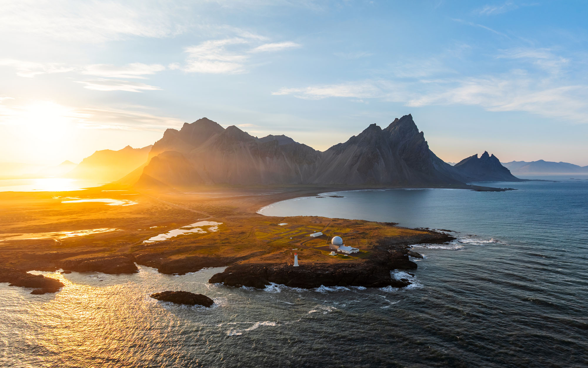
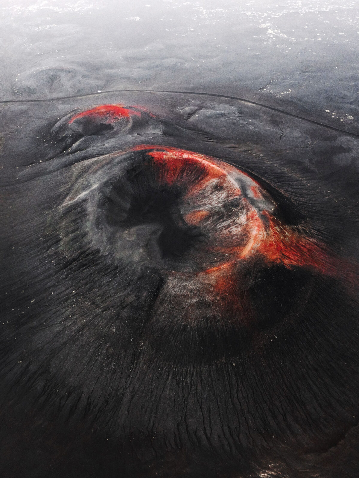
Iceland’s 2026 Drone Regulations: What Changed?
New Restrictions in Protected Areas Explained
The Quick Takeaway:
- No National Ban: Drones are not banned in Iceland. You can legally fly across the vast majority of the country.
- Protected Area Restrictions: Stricter rules apply exclusively to conservation zones, nature reserves, and specific national landmarks managed by the Nature Conservation Agency (Náttúruverndarstofnun).
- Standard Airspace is Open: Outside of these specific conservation zones, drone flights are fully permitted provided you follow standard European Union (EASA) and Icelandic Transport Authority (Samgöngustofa) safety rules.
- EASA Drone Laws Still Apply: You must still register your drone and respect local property lines and wildlife.
- Impact on Our Workshops: Because our itineraries are flexible, these shifting boundaries do not affect our workshops.
Shifting rules and exaggerated social media headlines have created considerable confusion about the legality of flying drones in Iceland. A common misconception circulating online suggests that the country has implemented a blanket ban on all drone flights. This is entirely inaccurate.
The aviation framework overseen by the Icelandic Transport Authority (Samgöngustofa) remains open, and drones are completely legal across most of the country. The recent policy adjustments apply specifically to designated nature reserves, national parks, and protected environmental monuments.
This blog post clarifies the structural changes within local conservation authorities, outlines the specific zones with restricted access, and explains how to safely research airspace boundaries before you head out to shoot.
The New Restrictions For Recreational Permits
The main change affecting visiting photographers occurred when the Nature Conservation Agency of Iceland (Náttúruverndarstofnun) modified its administrative criteria for processing drone applications inside its managed zones. On May 17th, 2026, the agency announced that it no longer issues permits for recreational photography or hobby flights within these protected borders.
Permit approvals are strictly limited to a specific list of objective purposes:
- Scientific research projects and environmental monitoring programs
- Official infrastructure supervision and construction management
- Commercial film and television production, including advertisements, news reporting, and broadcast programs
- Organized events that hold an independent, separate event permit
The specific locations impacted by this framework are categorized into three distinct regulatory groups based on seasonal wildlife and conservation needs:
Recreational flights and personal landscape documentation are completely unavailable throughout the entire calendar year at these locations:
- Akurey
- Drangar
- Dyrhólaey
- Geysir
- Gjáin í Þjórsárdal
- Goðafoss
- Gullfoss
- Háifoss og Granni í Þjórsárdal
- Hjálparfoss í Þjórsárdal
- Látrabjarg
- Mývatn and Laxá protected area
- Skógafoss
- Skútustaðagígar
- Stórurð
- The coastal perimeter at Stapi and Hellnar (Arnarstapi)
The next group of landmarks closes to personal aviation during the core summer months. Off-season applications can be requested via the island.is network, though final confirmation remains at the discretion of the review board:
- Blikastaðarkró-Leiruvogur
- Dimmuborgir
- Dynjandi
- Flatey
- Grótta
- Hornstrandir Nature Reserve
- Hólmanes
- Ingólfshöfði
- Lundey
- Snæfellsjökull National Park
- Þjórsárver
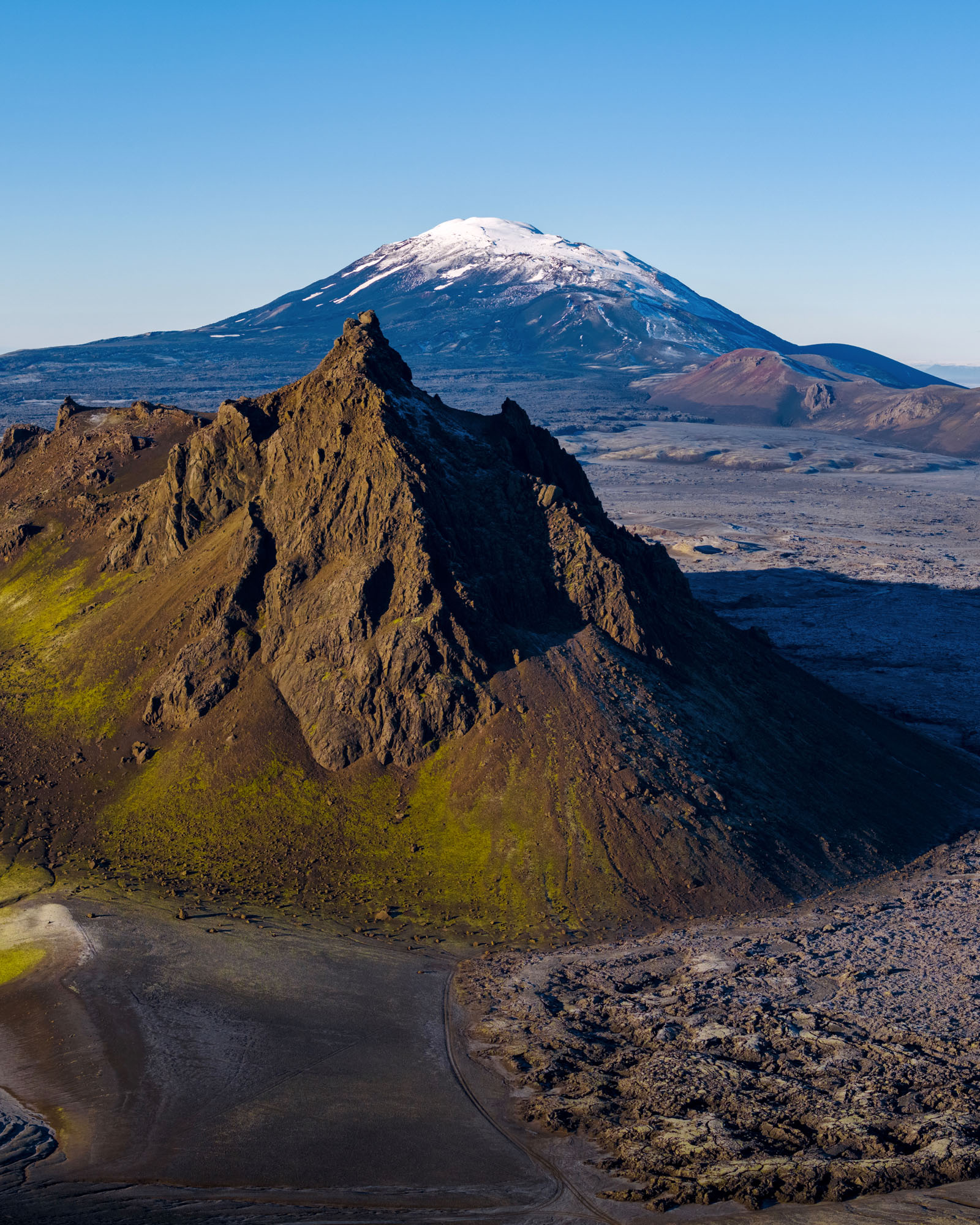
The Fjallabak Nature Reserve (Friðland að Fjallabaki) utilizes a targeted high-summer protection timeline. During this interval, only pre-approved scientific or industrial projects can apply for airspace access. Because the reserve boundary spans a vast interior territory, all coordinates within the perimeter follow this exact timeline.
The definitive regulatory documentation and ongoing local amendments are updated on the Náttúruverndarstofnun drone rules page.
Adaptability: Are Our Drone Photography Workshops Affected?
If you are joining us on a drone photography workshop, the short answer is: it will not alter your experience at all.
We work dynamically behind the scenes within the shifting administrative framework so that our guests never feel the logistical friction. Because we operate as an established, legally compliant local business, we manage drone logistics through a professional, dual-track system:
- Official Permits: For locations within restricted areas, we coordinate directly with regional land administrations to secure the required professional permits well in advance of our departure date.
- Unrestricted Locations: For the rest of our route, we utilize an extensive network of incredible, fully open sites that we have mapped out over years of operating in the field.
Whether a shot requires a pre-arranged permit or sits in entirely open airspace, we handle all the paperwork, tracking, and compliance. You don’t have to guess where it is legal to fly; you can just focus on your photography with complete peace of mind.
Our Position On Conservation and Industry Advocacy
As professional guides and photographers, we fully respect the rules established by Náttúruverndarstofnun. Preserving the quiet experience of nature and protecting local wildlife are shared priorities.
However, we firmly believe that professional photography can successfully coexist with conservation goals. Through deliberate organization, pre-planned flight paths, and operating during off-peak hours, aerial photography can be executed cleanly without disturbing other visitors or local fauna.
We are actively standing alongside other professionals in the local guiding community to engage with conservation authorities. We support collective efforts to find a balanced resolution with Náttúruverndarstofnun, with the ultimate goal of establishing a clear framework that could safely allow organized groups to operate under structured permits in the future.
This regulatory shift has sparked widespread conversation within the creative community, and we are not standing alone in this transition. We have spoken directly with several operators, local leaders, and fellow backcountry photographers who are navigating these exact same operational challenges and voicing similar structural concerns. The abrupt nature of these administrative adjustments has triggered considerable frustration and disbelief across the local photography scene, both within Iceland and among visiting international professionals.
Among these voices, we highly recommend reading the comprehensive analysis by our friend and landscape photographer Jeroen Van Nieuwenhove, who has published an in-depth breakdown of the current legal climate:
The institutional pushback reached a significant milestone on June 5, 2026, when the Icelandic Professional Photographers Association (Ljósmyndarafélag Íslands) issued an official public statement regarding these new permit-processing trends. In their formal statement, the association openly challenged the systemic denial of drone authorizations on protected lands, labeling the current practice by Náttúruverndarstofnun as discriminatory against qualified photographic professionals.
- Ljósmyndarafélag Íslands: New administrative law on drone permits in protected areas
Not a Free-For-All: The Rules Still Apply
Even outside protected agency lands, all pilots must strictly adhere to the national aviation framework managed by Samgöngustofa to avoid steep fines or equipment confiscation.
If you plan to fly in Iceland independently, you are legally required to follow these baseline rules:
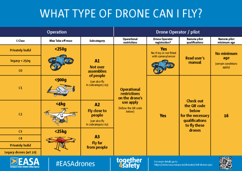
- Mandatory Registration: Under EASA and Samgöngustofa frameworks, any drone equipped with a camera or sensor capable of capturing personal data requires operator registration, regardless of weight. The sub-250g weight exemption applies only to drones with no camera or those explicitly classified as toys. If you fly a mini photo drone (like a DJI Mini series), you must register as an operator on Flydrone.is and display your operator ID code on the aircraft.
- Crowd Restrictions: It is strictly forbidden to fly directly over crowds of people or assemblies. You must maintain a safe horizontal buffer from bystanders.
- Privacy & Proximity: Flying close to residential areas, public infrastructure, or private property without explicit permission is legally restricted.
- Local Signage: Many individual landowners, municipalities, or specific tourist spots (such as popular waterfalls) have posted local drone bans to prevent noise pollution or protect nesting birds. These signs carry legal weight and must be obeyed.
Is There a “Drone Map” for Iceland That Shows Where I Can Fly?
While a central tracking map does exist, using a single digital tool to verify flight legality is rarely straightforward. The Icelandic Transport Authority offers a public platform designed to centralize restricted flight zones across the country. However, treating this map as a definitive final verdict is risky; it often misses real-time operational updates, omits local land boundaries, and incorrectly labels temporary, seasonal restrictions as permanent bans.
Achieving genuine legal compliance requires looking past a single interface. To guarantee every flight is fully authorized before a drone ever leaves the ground, our process involves cross-examining three separate information layers:
- The standard Transport Authority map – a baseline reference.
- Cross-check boundaries directly with the Nature Conservation Agency portal, which holds the ultimate legal authority over reserve lands and overrides generic map data.
- Regions like Vatnajökull, Þingvellir, and Snæfellsjökull operate under their own autonomous local administrations, enforcing unique regional rules and rolling seasonal wildlife closures.
Fly Without the Headache: Join Our Workshops
Our dedicated Drone Photography Workshops are explicitly designed to take these complex operational logistics completely off your plate. Because we are an established local operator, we monitor changes in laws, regional council bylaws, and dynamic commercial boundaries in real time. We handle the strict perimeter tracking and airspace compliance on the ground, ensuring our flight paths remain entirely within legal, open airspace without any guesswork.